Boksburg
Boksburg is a city on the East Rand (Ekhuruleni) of Gauteng province of South Africa. Gold was discovered in Boksburg in 1887. Boksburg was named after the State Secretary of the South African Republic, W. Eduard Bok. The Main Reef Road linked Boksburg to all the other major mining towns on the Witwatersrand and the Angelo Hotel (1887) was used as a staging post.
Boksburg has been part of the City of Ekurhuleni Metropolitan Municipality since 5 December 2000, which forms the local government of most of the East Rand.
The Mining Commissioner Montague White built a large dam which, empty for years, was dubbed White's Folly until a flash flood in 1889 silenced detractors. The 150,000 square metre dam is now the Boksburg Lake, and is surrounded by lawns, trees, and terraces.
Prior to 1860, the present municipal area of Boksburg and its immediate environs comprised mainly the highveld farms called Leeuwpoort, Klippoortje, Klipfontein and Driefontein. Carl Ziervogel bought the farm Leeuwpoort in 1875 and for 300 morgen of barren, rocky veld he paid £75. In September 1886 Pieter Killian, a young Afrikaans prospector, discovered quartz reefs on Leeuwpoort. He also discovered quartz reefs on the farm Vogelfontein, named after Adolf Vogel.
Samples of the quartz were sent to Pretoria for assaying,which confirmed the presence of gold. Killian advised Dr W.E. Bok, Secretary of State for the Transvaal Republic, of the results of the assay. The result was the proclamation, on 10 March 1887, of the two farms as public diggings. Carl Ziervogel, who had been trying to sell Leeuwpoort, now opened the first gold mine on the East Rand, the Ziervogel Gold Mining Company.
Cornish miners were brought out to work the diggings. Unfortunately, it soon transpired that heavy expenditure was necessary for development, and as the Directors were unable to finance this, the mine closed down.
Mr Abe Bailey of the Barnato Group, which owned the Johannesburg Consolidated Investment Company (JCI), bought the farm Leeuwpoort in 1894 for £100,000. The mynpacht (mining lease) was controlled by JCI, who established E.R.P.M. Ltd, which is still carrying on mining operations after 120 years. JCI also developed many residential suburbs over the years.
Gold was also found at Elsburg, 8 km to the southwest. Elsburg was a recognized stopping point for coaches and wagon traffic. The first Government offices were at Elsburg and what was to become Boksburg was but a suburb of Elsburg. With the real centre of mining being centred on Boksburg, however, soon President Paul Kruger ordered that a new town be laid out to accommodate the miners. Land for the new town was released by having the boundaries of the farms Leeuwpoort, Driefontein and Klipfontein moved back from where they met. The newly created farm was called Vogelfontein, on which 1000 stands of 50x50 feet each were created. The new town of Boksburg was named after Dr Bok. In 1887 the first auction sale of stands took place, at which prices of £5 to £25 were realized. Also in 1887 the Republican Government built the Post Office and the Mining Commissioner's office. Business and residential properties began to be built in the fledgling town in its first year of existence. In 1888 coal deposits were discovered right on the boundary of the new town, and here coal was first mined in the Transvaal. This started an era of company promotion and syndicate formation, with ground fetching high prices. Enterprises of all kinds were set up and Boksburg began to emerge from a mining camp atmosphere to a fully-fledged town. Coal ensured that the gold mining industry would grow to a formidable size.
Originally, Boksburg was laid out in 1887 to serve the surrounding gold mines, and named after the State Secretary of the South African Republic, Eduard Bok. The Main Reef Road linked Boksburg to all the other major mining towns on the Witwatersrand and the Angelo Hotel was used as a production post. A railway was built by the Netherlands-South African Railway Company (NZASM) to link Boksburg to Johannesburg in 1890.
The first coal mine was called Gauf's Mine after the Manager Mr J.L. Gauf. Others were the Good Hope, Ferndale and many more. There now arose a pressing need for a more sophisticated coal distribution system than using teams of ox wagons. The mine owners strongly advocated a railway line between Johannesburg and Boksburg, but this was opposed by the wagoners. President Kruger managed to persuade the Volksraad to approve the building of a "tram" line, ostensibly to transport passengers only! The Rand Tram (so named as to appease the transport riders) opened in 1890, between Johannesburg's Park station and Boksburg station. The line was subsequently extended to Brakpan and Springs, where large deposits of superior quality coal had been discovered. Also, deposits of high grade fireclay were discovered in Boksburg, which gave impetus to development of a fireclay manufacturing industry. All this helped the importance of the gold mining industry. Coal mining came to an end in 1895 after underground fires broke out, rendering the entire mining area unsafe.
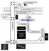
Map - Boksburg
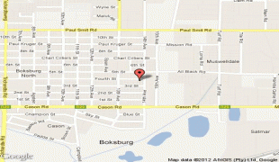
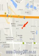
Map


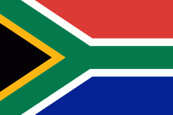
Country - South_Africa
 |
 |
| Flag of South Africa | |
About 80% of the population are Black South Africans. The remaining population consists of Africa's largest communities of European (White South Africans), Asian (Indian South Africans and Chinese South Africans), and multiracial (Coloured South Africans) ancestry. South Africa is a multiethnic society encompassing a wide variety of cultures, languages, and religions. Its pluralistic makeup is reflected in the constitution's recognition of 11 official languages, the fourth-highest number in the world. According to the 2011 census, the two most spoken first languages are Zulu (22.7%) and Xhosa (16.0%). The two next ones are of European origin: Afrikaans (13.5%) developed from Dutch and serves as the first language of most Coloured and White South Africans; English (9.6%) reflects the legacy of British colonialism and is commonly used in public and commercial life.
Currency / Language
| ISO | Currency | Symbol | Significant figures |
|---|---|---|---|
| ZAR | South African rand | Rs | 2 |
| ISO | Language |
|---|---|
| AF | Afrikaans language |
| EN | English language |
| ST | Sotho language |
| SS | Swati language |
| TS | Tsonga language |
| TN | Tswana language |
| VE | Venda language |
| XH | Xhosa language |
| ZU | Zulu language |